Chehalis Basin Collaborative for Salmon Habitat

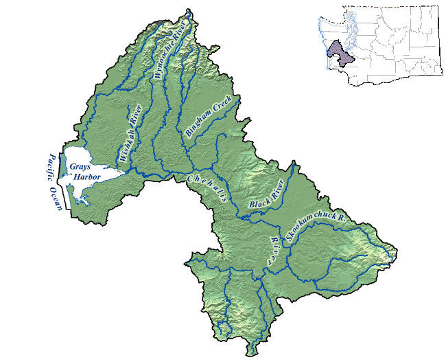
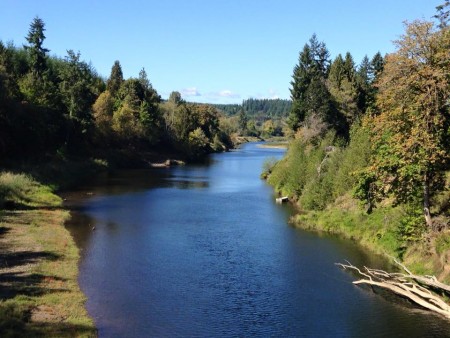
The Chehalis Basin Collaborative for Salmon Habitat is comprised of Watershed Resource Inventory Areas (WRIA) 22 and 23. The Chehalis River basin is the second largest watershed in the state. Within the 2,600 square miles that make up the basin, there are more than 3,300 miles of rivers and streams. The Chehalis River starts in the Willapa Hills and flows downstream to the Grays Harbor estuary and the Pacific Ocean. Throughout the Chehalis basin, forestlands dominate the landscape, while agricultural and urban areas are also common. The basin has more than 140,000 residents spread across eight counties (Cowlitz, Grays Harbor, Jefferson, Lewis, Mason, Pacific, Thurston, and Wahkiakum) and one tribal reservation (The Confederated Tribes of the Chehalis). Waters of the basin including Grays Harbor estuary support a variety of fish and wildlife species.
The Chehalis Basin Collaborative for Salmon Habitat is guided by the Habitat Work Group, a group of stakeholders in salmon recovery in the Chehalis. These stakeholders include: counties, conservation districts, Tribes and Indian Nations, non-governmental conservation organizations, land trusts, business interests, landowners, citizens, regional fish enhancement groups, and techncial staff from state agencies. Together they develop, plan and prioritize restoration and preservation projects, using the Chehalis Basin Salmon Habitat Restoration and Preservation Strategy for WRIA 22 and 23.


Lead Entity Coordinator
1(360)488-3232
Department of Natural Resources, Chehalis Tribe
420 Howanut Rd
PO Box 536
Oakville, WA 98568
http://www.chehalisleadentity.org/
Committee meetings occur on the first Monday of the month from 9:30 am to 12:30 pm.

